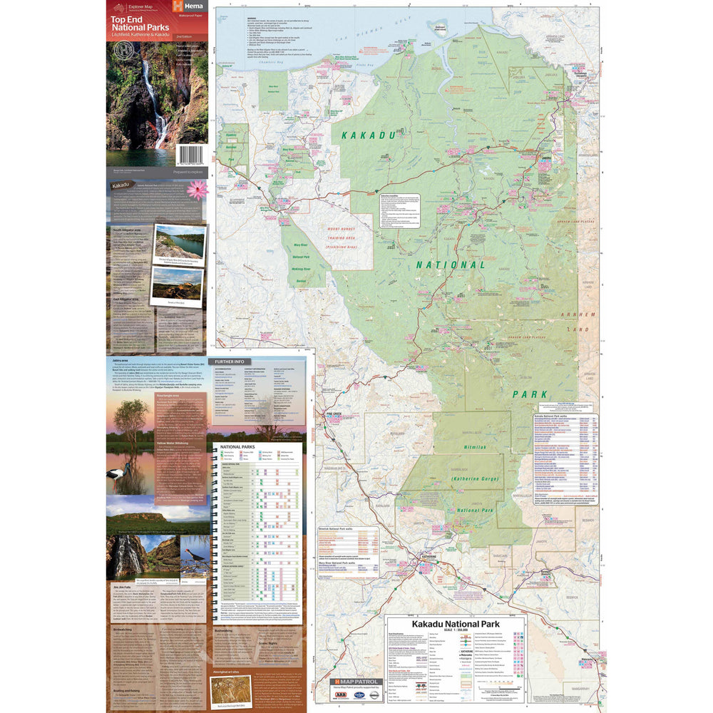

A regional map that features Litchfield (1:160,000), Katherine Gorge and Kakadu (1:350,000) national parks.
A Darwin region map is included (1:850,000) along with extensive tourist information for Darwin and the surrounding region, Arnhem Highway to Kakadu, Mary River, Stuart Highway to Katherine, Litchfield National Park, Katherine Gorge (Nitmiluk) National Park and Kakadu National Park. Also included are national park facility listings in addition to contact details for accommodation and visitor centres in the region.

We stock the full Weber BBQ range including the New Premium Weber Q's, the Genesis, Genesis Smart, Spirit Smart, & Spirit II Ranges, the classic Charcoal Kettles, the all new SmokeFire Pellet Barbecues, and a full range of accessories for everything Weber!

One of Australia's biggest camping and outdoor brands, you'll struggle to find a campground or market in Australia without an OZtrail Gazebo in sight! Check out the range of OZtrail gear below including the new Fast Frame tent range, and of course the classic OZtrail 3 metre Gazebo!

We stock a large range of Sea to Summit lightweight gear - everything from Dry Bags and Microfibre towels to Collapsible Bowls and Ultralight Pillows. Their lightweight yet durable products are perfect for any hiker, trekker, camper, tourer or traveller.