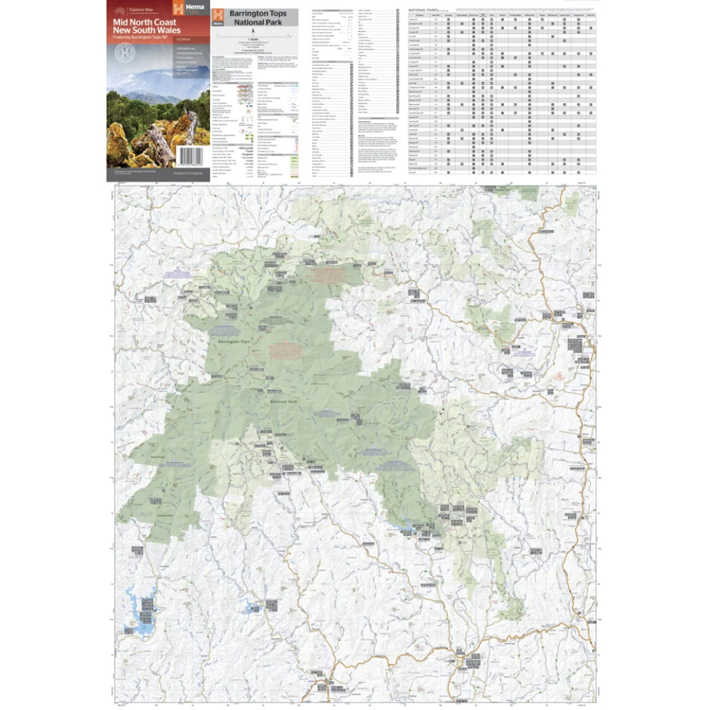

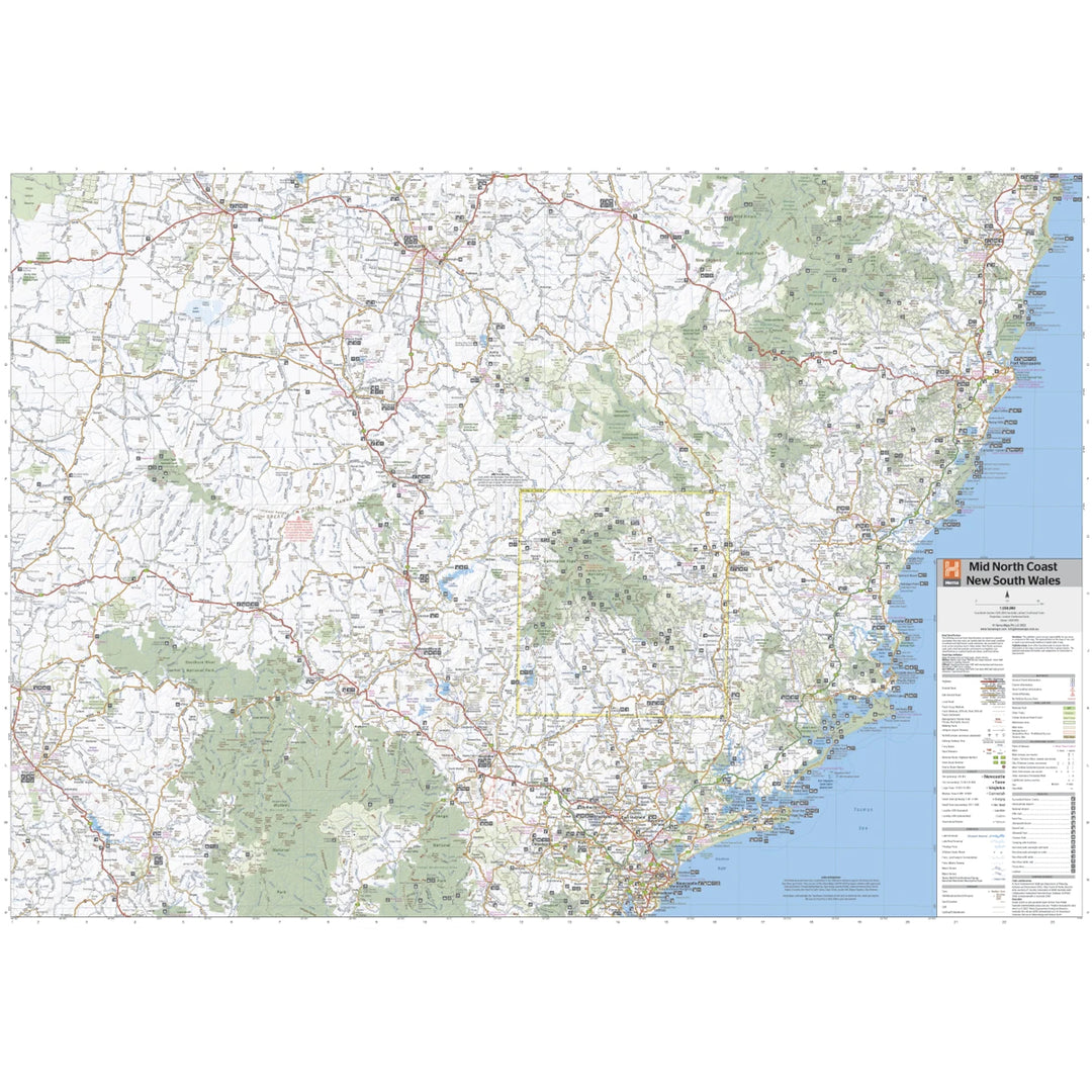


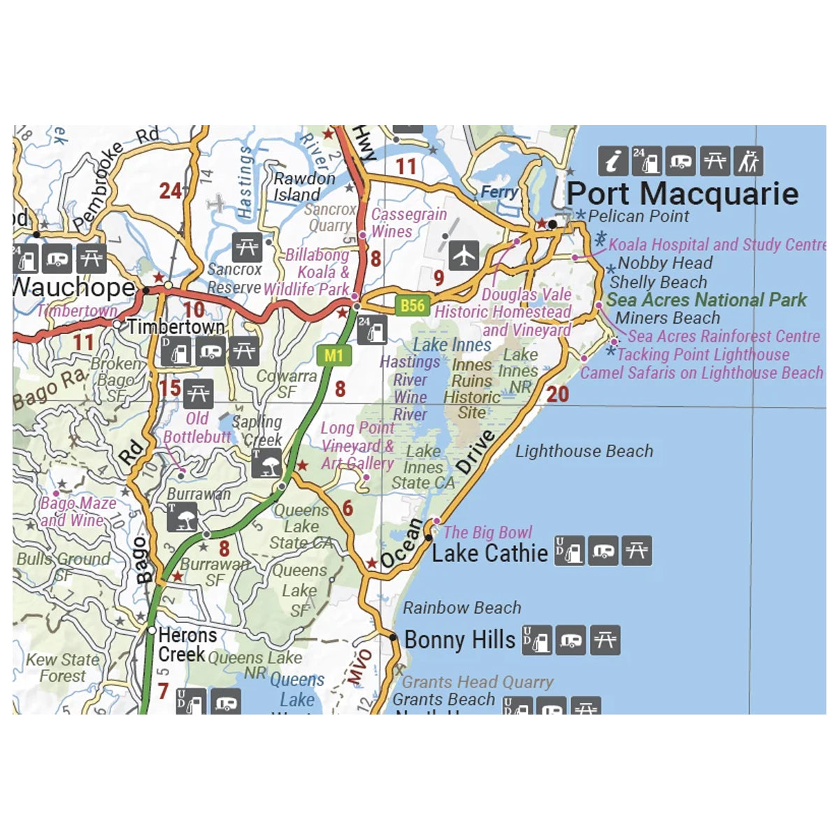
A regional map of the Mid North Coast of New South Wales (1:350,000) that ranges from Northern Newcastle, west to Mudgee, as far as Gunnedah in the North and East to Port Macquarie.
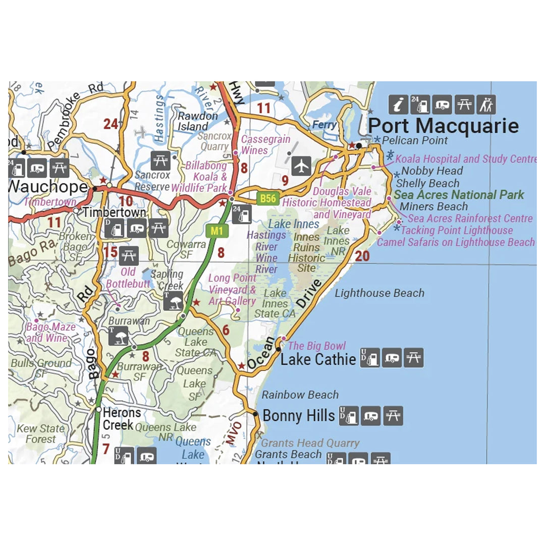
Covered regions in the map include; Gunnedah, Tamworth, Mudgee, Port Macquarie, Maitland, Kempsey, Taree, and Forster.
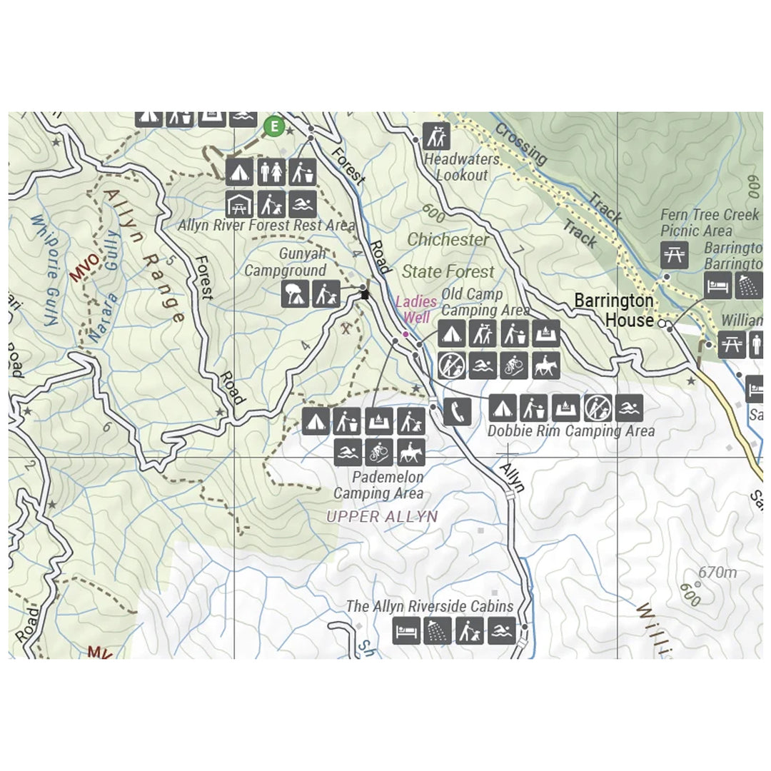
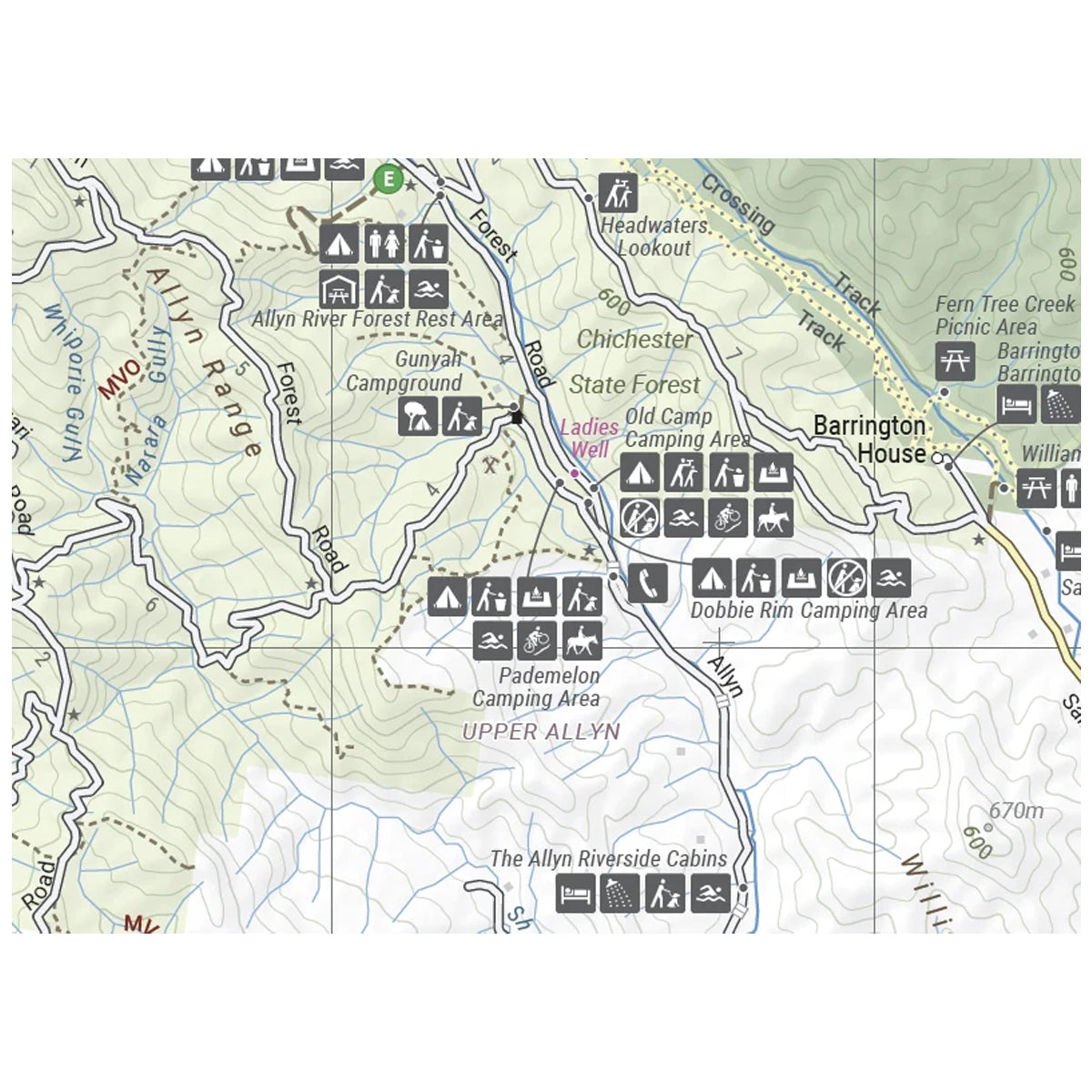
Also includes the following National Parks; Barrington Tops NP, Oxley Wild Rivers NP, Hat Head NP, Carrai NP, Werrikimbe NP, Cottan-Bimbang NP, Mummel Gulf NP, Nowendoc NP, Curracabundi NP, Wollemi NP, Goulburn River NP, Yengo NP, and Towarri NP.
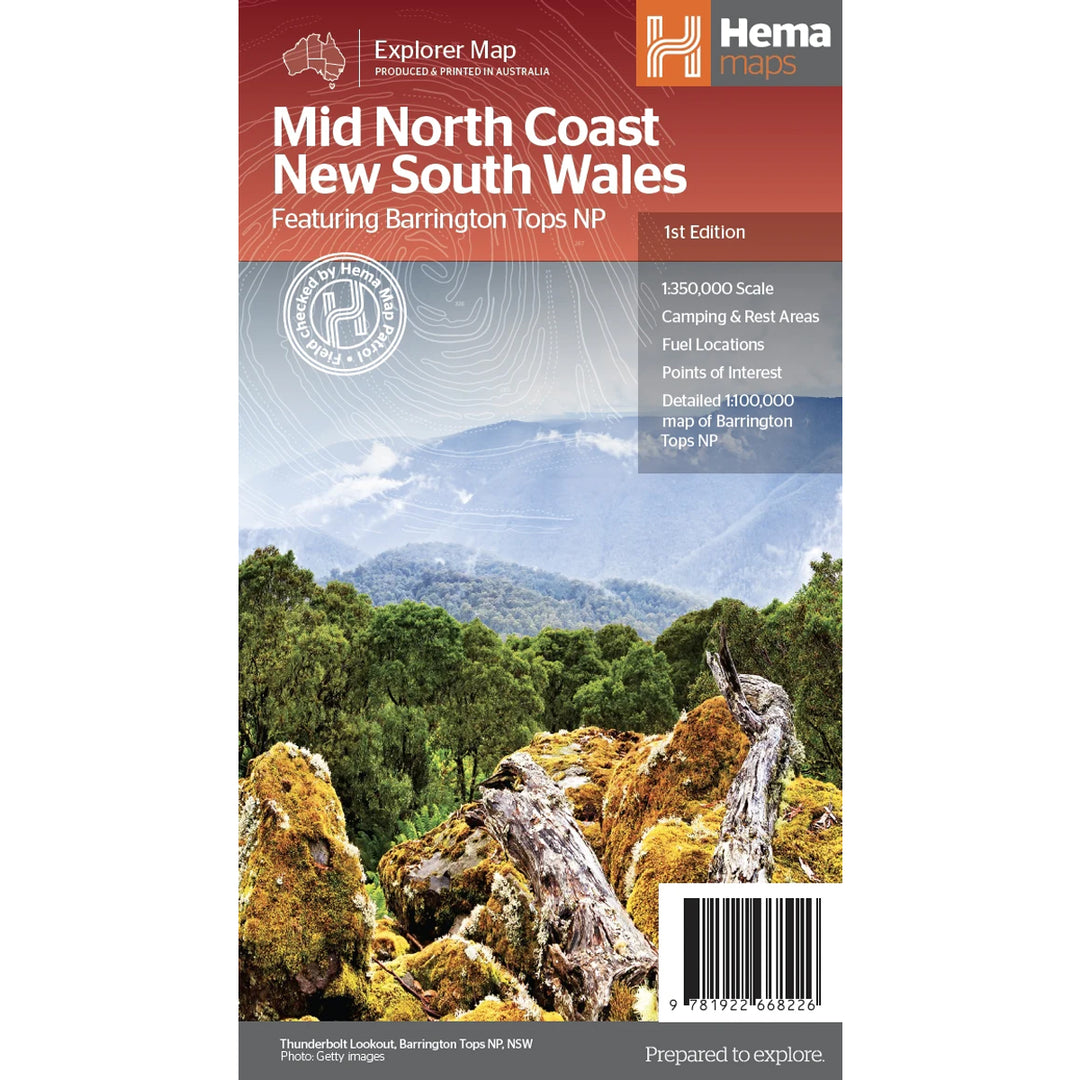
On the opposite side is a detailed inset map of the Barrington Tops National Park (at 1:100,000 scale) plus extensive information on numerous regions, including visitor, historical and background information.

We stock the full Weber BBQ range including the New Premium Weber Q's, the Genesis, Genesis Smart, Spirit Smart, & Spirit II Ranges, the classic Charcoal Kettles, the all new SmokeFire Pellet Barbecues, and a full range of accessories for everything Weber!

One of Australia's biggest camping and outdoor brands, you'll struggle to find a campground or market in Australia without an OZtrail Gazebo in sight! Check out the range of OZtrail gear below including the new Fast Frame tent range, and of course the classic OZtrail 3 metre Gazebo!

We stock a large range of Sea to Summit lightweight gear - everything from Dry Bags and Microfibre towels to Collapsible Bowls and Ultralight Pillows. Their lightweight yet durable products are perfect for any hiker, trekker, camper, tourer or traveller.