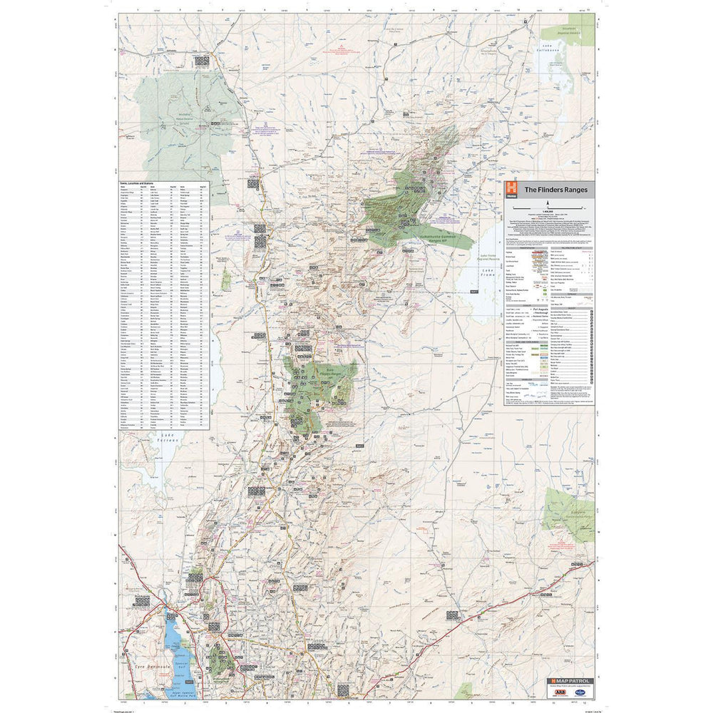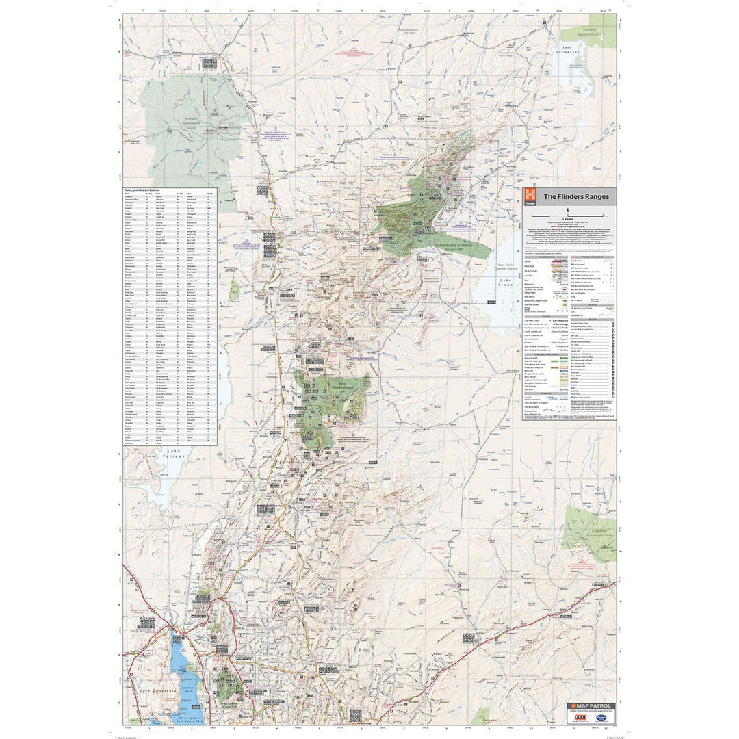
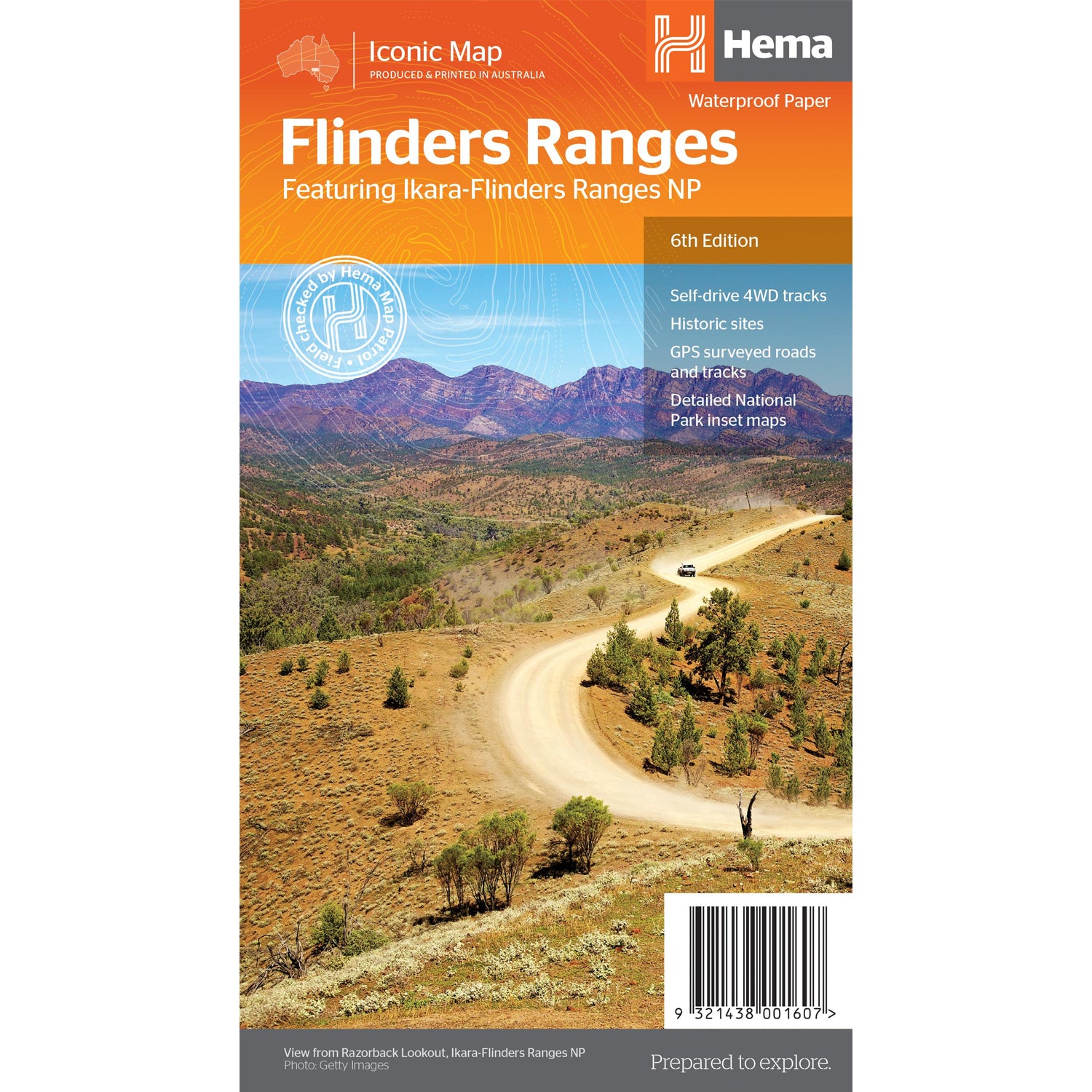
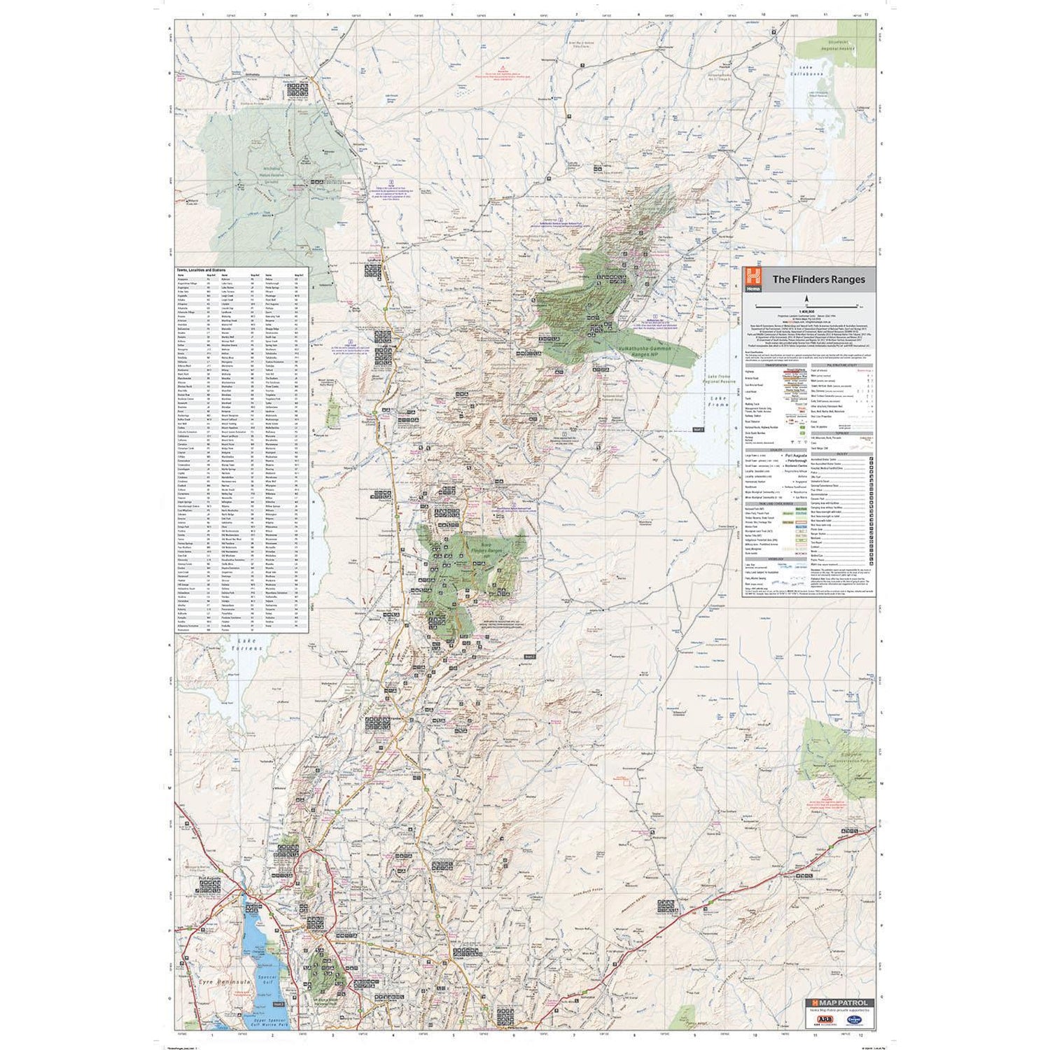
This waterproof map of South Australia's Flinders Ranges includes inset national park maps and visitor information on the spectacular Flinders Ranges and Vulkathunha-Gammon Ranges, including information on the history and traditions of the Adnyamathanha people — making trip planning and navigation simple. Accompanying tourist information includes self-drive 4WD treks, historic sites and contact details listed for national parks and reserves.

We stock the full Weber BBQ range including the New Premium Weber Q's, the Genesis, Genesis Smart, Spirit Smart, & Spirit II Ranges, the classic Charcoal Kettles, the all new SmokeFire Pellet Barbecues, and a full range of accessories for everything Weber!

One of Australia's biggest camping and outdoor brands, you'll struggle to find a campground or market in Australia without an OZtrail Gazebo in sight! Check out the range of OZtrail gear below including the new Fast Frame tent range, and of course the classic OZtrail 3 metre Gazebo!

We stock a large range of Sea to Summit lightweight gear - everything from Dry Bags and Microfibre towels to Collapsible Bowls and Ultralight Pillows. Their lightweight yet durable products are perfect for any hiker, trekker, camper, tourer or traveller.